
December rolls around and once again our thoughts start to drift south of the border, down Mexico way. It’s time again for our annual bird count, and carne machaca, both at the end of our long drive south. Two days for a complete change of scenery, and given the snow and the rain and the resulting mudflats we had out in the back, we were ready for it.
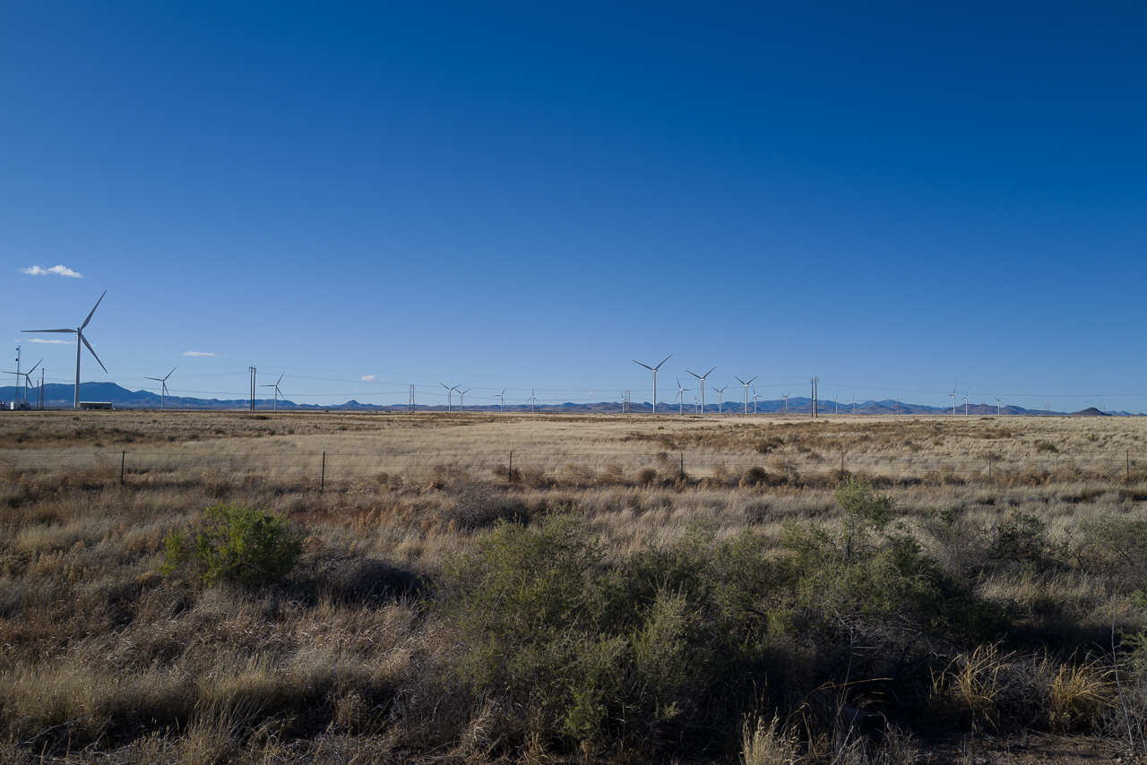
Departure day arrived and with the car loaded we headed out into a stiff headwind. It’s never fun to drive our boat of a car when it’s windy – keeping it in its lane is a full-time job, a matter of constant attention and quite tiring. And doing it until we turned right and headed west into the sunset meant 3 solid hours of undivided attention. But eventually, we crossed the Rio and took the turn to Hatch, passing Sparky’s and their amazing collection of fiberglass, burger-serving statues looking down upon travelers from the edge of the roof and then it was off on a southwest heading, past the wind farm and eventually across the bone-dry Mimbres River, the one constant reminder that this is a desert and then back on to another interstate guided now by an orange sun hovering above the highway.

We stopped outside Deming for a quick stretch of the legs and noticed that the Jefferson Davis memorial was now removed from the middle of the rest-area sidewalk. I was glad to see it gone, given the Confederacy’s pathetic march through New Mexico during the Civil War, a half-hearted attempt to build defensible supply lines in their western “invasion” that aimed to capture the goldfields first in Colorado and later in California. Following a few brief skirmishes in the south-central part of the state, supported by the locals who felt the Federal government was mean to them, the army went on to occupy both Albuquerque and Santa Fe before it all came to an end at the Battle of Glorieta Pass, just north of our state capital. The Confederates successfully pushed the Union forces through the pass and all was going to plan before sneaky Bluecoats got behind the advancing Confederate lines and burned all their supply wagons, supposedly while General Sibley was passed out drunk in one of them. One look at no food, horses, or ammunition a few hundred miles from the closest bit of Texas put an end to the grand adventure and so they turned around, stopping in the occupied cities to pull down their flags before heading home.
For me, the absence of the memorial was good news as that woeful chapter of history didn’t merit being marked, and we certainly didn’t need a monument to a racist regime. I thought the bumpy square of patched concrete was a more than adequate reminder of Davis’ legacy.
Past Lordsburg, we descend slowly into the Las Animas valley, crossing the playas, modern remnants of ancient Pleistocene lakes, formed as the great ice sheets receded and water flowed down into this broad depression, hemmed in by the Animas and Peloncillo Mountains. Some water is always present in these flats, but on this late afternoon, its extent was greater than we’d ever witnessed – literally as far as we could see on both sides of the highway. The broad expanse of shiny, wet desert and green sagebrush spoke clearly to the amount of rain and snow the area had seen recently. No doubt the precursor to the drenching we’d received up north.
While driving into the setting sun is never fun, it’s better during December when it finally sets early off to the south, blocked by the Chiricahua Mountains, whose rough points are said to depict the profile of the Apache’s last great leader, Cochise, who now rests in a hidden grave somewhere in one of the hundreds of rough and inaccessible canyons that fracture these hills. There is so much recent Native American history along this road that it’s almost palpable. Between these mountains and the Gilas to the southeast where Geronimo finally surrendered, it’s barely been a century since those events unfolded.
The outlying roads of Tucson are the first evidence that the trip is almost done, followed by one last challenge of navigating the confusing merging of a couple of interstates and then we’re there, at cousin Barbara’s and then on to dinner at our friendly sophisticated pizza joint with her and our friend Chris from Switzerland, visiting in Tucson for a month or so.
The next leg of the trip is always pretty much the same. Head south, stop for groceries in Green Valley, gas up at the first station in Nogales and then slowly inch across the international border. Every time we cross, things are a little bit changed – a different serpentine route, new speed bumps, another confusing lane through a non-occupied checkpoint. For a moment, the path turns east and we’re in sort of a no-man’s land, between the giant steel fence that forms the actual border and a towering wall of welded-rebar bins, filled with rocks that form the base of the plaza above where you wait to get back into the US. On the way down, MLW had read an article about this crossing (and its cousin in downtown Nogales) that were swamped with travelers during the Thanksgiving weekend. Apparently, desperate asylum seekers had taken to trying run across through the car lanes so the CBP had responded by blocking many of them with shipping containers. The result – 11-hour waits for people trying to return from a holiday trip down south. As we turned south, we checked to see just how long the return lines were, and it was not pretty – a single lane of cars stretching for perhaps a mile. Ah well, something to look forward to next week.
Over the course of the last 5 years, Mexico has been rebuilding Highway 15, and now the results were apparent – a nice smooth well-appointed road with a decent shoulder as far as the eye could see. Certainly worth the prices of all those dangerous detours and diversion we’d endured on previous trips. One last section remained north of Imuris, but its inconvenience was minor, just some unpaved patches and a few miles of two-lane traffic.
After one of MLW’s famous in-car lunches, we were finally closing in on the much-anticipated part of our trip – the new Hermosillo bypass. In the past, you had two options when you arrived at Sonora’s capital city – head straight through town and endure countless traffic lights and lots of traffic, or take the pereferico – the bypass that replaced the through-town stress with completely different stresses of its own – killer speed bumps, twisty streets, traffic, school kids and terrible road surfaces. Yes, it’s faster and yes, it offers a genuine Mexican driving experience, but boy oh boy it’s tough on one’s demeanor. So given the stories I’d heard, it was going to be so nice to have a brand new way to go.
Just past the Hermosillo toll booth (workers on strike, no tolls to be paid), a big new sign said: “Take the new road” in Spanish of course with some new words like “corta” and “libramiento” which meant nothing to us. So we did, exiting off to the right. A quarter-mile up the road, another big sign sort of suggested we should do a u-turn, so I pulled off onto the shoulder behind a pick-up truck from Oregon that was having the same confusion. Allowing for the other confused traffic to clear, we made the u-turn and headed back to where we’d just come from. Looking ahead it was clear what was going on – we were about to re-enter the road we’d just left, heading back the way we’d just traveling. So we followed the line of cars, circled down the entrance back on to the highway, but instead of going back to the US, we took a quick exit to the right and went off into the desert east of the city.
If all of that was confusing to follow, imagine our state of mind. Leave the southbound highway and head west, then do a u-turn and head east, then take an exit and head north before taking another exit and heading east again. Got that? Why was it this way you ask? Because they hadn’t yet finished the overpass necessary to exit the southbound road to the eastbound road. Instead of just setting up a simple left turn, they created a maze.
The new road turned out to be a mixed blessing. A beautiful smooth two-lane highway out into the middle of nowhere with an $8 toll and lots of crazy truck drivers, the highlight of which had us trapped behind a slow-moving semi in a no-passing zone with another semi coming at us and a third one barreling up in my rearview mirror. The one behind us simply moved to the middle of the road forcing the oncoming truck onto its shoulder and doing the same to the semi I was trying to pass. For the briefest moment, we had 3 semis abreast in two-lanes with me stuck behind visualizing what I was going to do to avoid the cloud of debris that would come from two of them crashing head-on.
Gratefully, it didn’t come to that and we finally passed the slow guy only to catch up with the crazy guy as the new bypass rejoined to main highway. The final analysis – a much longer drive to avoid some traffic and the twisty neighborhood streets.
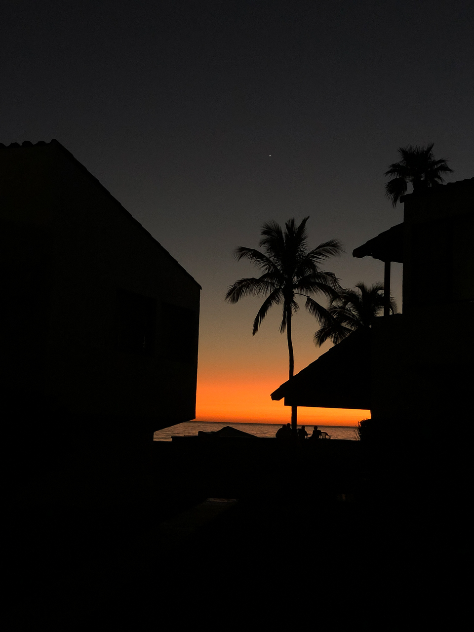
The rest of the trip was boring, thankfully and we arrived well before sundown. Our place was crowded with cars as some photographer was doing wedding shots (popular with the locals because of the gardens and ocean view) which impeded my unloading of the truck only for a moment or two. We got our place set up, watched the sun go down and ended the day with a beer and a hot bowl of Tortilla Soup at Rosa’s.


Holy white knuckles on the libramiento! Wow! I have difficulty imagining you being very calm in a situation like that. I did not remember that civil war history. Love the roof top hamburguestas! Great blog post. 5 stars.
Again great reading pleasure.